Forum Replies Created
-
AuthorPosts
-
MWParticipant
Hi markwood
Thanks for your response.
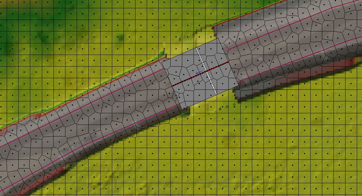
Below is a snapshot of how i had it modelled. I had breaklines to define the raised embankment. Where there are culvert crossings, I’ve created a gap in the terrain model and filled it in with a SA/2D Area Connection of weir/culverts.
If I read your explanation correctly, i’ve already addressed the issue of cell faces aligned with the top of embankment. Do you have any ideas about what else could be the problem?
Thanks so much for your help!
 MWParticipant
UPDATE:
I was able to run the model by reducing the time step to 20 seconds (it was 5 mintues before).
I had precipitation as the flow type for the 2D flow area in both cases 1 and 2 (existing terrain and terrain with road embankment running through).
The results with the road embankment seem to indicate almost no flooding/ water ponding happening anywhere within the 2D mesh. This seems strange as i’m using exactly the same unsteady flow file for both plans but the existing case runs with a great deal more ponding/ flooding than the 2nd case which is counterintuitive. I’d expect a lot more upstream ponding due to the road embankment.
Any guesses as to why these results are coming up?
Thank you!
MWParticipantHi
I’ve overlaid 3 different terrain files to create one combined 2D mesh.
The final mesh however has small gaps in it which stops the unsteady flow calculations from going through.Any ideas on how to fix this issue?
many thanks,
MW
MWParticipantHi Jarvus
I’m having issues modelling culvert crossings through a road embankment in which the terrain data elevation and the weir elevation data are the same. Hec-Ras won’t let me run the unsteady simulation because my culvert invert sits below the grid elevation (which is of the road centreline so realistically, my culvert should sit below this elevation).
You mentioned this situation below:
“There can be some confusing issues between what is in the terrain data and what is in the weir elevation data. For the elevation of the top of the road (this is the elevation part of the user entered station/elevation data), does this elevation match what is in the terrain? If so you can ignore the next discussion.”How do I get around this issue?
Is there an alternate method to model culvert crossings in a 2D flow area?Thanks
-
AuthorPosts