Forum Replies Created
-
AuthorPosts
-
Joe S.Participant
the error happens without a hot start, and even after I tried to make a hot start file. I might not be creating the hot start correctly.
May 21, 2016 at 5:24 am in reply to: unsteady flow encountered error, RasDSSWriter64.ext Exit code = 1 #9916Joe S.ParticipantI was able to have the model run with a lateral structure (spillway) through the dam. The geometry no longer shows the lateral connected to the cross section below the dam. odd. but it clearly shows there is a connection. I got the model running only the PMF, without dam failure.
For the PMF with dam failure, i am using a renamed geometry temporarily since I have been attempting numourous minor changes. But still does not run to completion. From the visual graphics shown in RAS Mapper, the water literally stops at the 2D interface (adjacent to the 1D). I have the 2D overlapping correctly.
-using full momentum wave for dam failure and better stability.
– tried raising the the 2D initial elevation from 1 to 20 ft vertically.
– tried a smaller 50 ft mesh.
– the end of RS (1D) stream elevation is set at 1325.8. The 2D terrain adjacent elevation is 1325.2. I understand that the 1D channel should be slightly above the 2D.You mentioned making sure the 2D area does not go dry.
– set the initial 2D elevation at 1330, and even tried higher starting point.
– tried 1 to 3 hours for 2D initial conditions.
– tried 2D initial ramp up fraction 0.1 to 0.6
– tried 1D/2D ramp up from 0 to 20.the terrain drops gradually from elevation 1330 ft (at the dam) to elevation 1240 ft. so not certain with a 90 ft change, if I should break the downstream terrain into more than one 2D area?? then interconnnect them with SA/2D Area connections.
appreciate any further suggestions and comments.
Joe S.Participantappreciate the older blog. he explained a step the manual left out. now it looks better between the stream banks. Can a terrain with channel be put into a different subdirectory? Or can it be named differently?
Joe S.ParticipantI am new to posting comments. I had gone to the thread you recommended. very helpful. I tried to add a comment there, but not sure if it will be read.
my post was…….
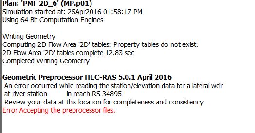
I have added a few SA/SD locations within my 2D geometry, as instructed above. After I save geometry, and compute. the program freezes during Geoemtry Processing. There error in red says “review your data at this location (ie the SA/SD location) for completeness and consistency”.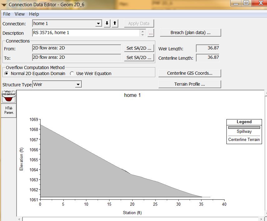
 Joe S.Participant
Okay, that makes sense now with the link. could not find it in my blog search. thank you for explaining.
Joe S.ParticipantI shifted the roadway downstream a cell width, to pick up a lower true channel invert elevation. Now I can adjust my culvert inverts lower. thank you.
-
AuthorPosts