Forum Replies Created
-
AuthorPosts
-
godzillaParticipant
In case anyone else experiences this. I got the sections to display by:
in Geometric Data – GIS Tools
GIS Cut Lines
Remove GIS Cut Line Data
Accept Displayed Locations (As Georeferenced)Plot GIS Profile Reach Bounds
And they appeared.godzillaParticipantWell, i just highlighted the start el. column and picked copy inv, and voila. As for now it seemed to fix it.
godzillaParticipantWell it is obvious I did not know about that part of the table. ha. I was expecting peak flow and didn’t notice the time in the profile tab.
Thank you for your responses. You can take the rest of the day off.godzillaParticipantI have tried that, but the value for culvert group is 0.00 in that and any other table . I know there is flow through it. Water depth is 9′ on upstream side and 2′ downstream side, velocities .13 upstream and 1.6 downstream. Thanks for your answer though.
godzillaParticipantI fixed it. The range for stagnation points were too great. I had overlapping ranges for the bridge to culvert and culvert to culvert. I set all ranges to begin at the end range of the preceding opening type.
I still can only login when I reset my password and hit the hec-ras help link. I can then post but cannot attach anything. When I post this and logout, the only way back in is to reset password.
godzillaParticipantI thought I would do a 1D for the prelim and 2D for the final. I have never done a 2D but I followed the latest Modeler’s Manual and created a 2D geometry. I am only doing a small portion of a large river system. The only question for me would be the Hyrdograph that rains on the mesh. Can create a hydrograph for the various year storms. I will read up a little more. The main objective of the study is to get the velocity and water surface elevation in the floodplain (6500′ wide) where there are culverts under a gravel road that winds perpendicular to the river. I read where 2D would be better for a very flat surface.
I put in a request to my boss to do the upcoming online 1D – 2D class.
Thank you for answering.godzillaParticipantThank you for the reply. I can imagine the freezing and crashing. I wasn’t too eager to install it and now I won’t. It is so easy to import and export between the two, why tempt fate?
May 31, 2019 at 1:37 am in reply to: Help in understanding how .dss from HMS works vs flow file #12263godzillaParticipantThank you Cameron. That is what I needed to know. I have input the info for a hydrograph in unsteady flow files before.
Am delineating a regulatory floodway and need to run a steady and refine with unsteady. Two project files I assume.
godzillaParticipantI added a section close to the bridge and it fixed it.
godzillaParticipantWell I fixed it, but not sure how it happened. The short reach created from the import doubled back on itself once or twice. I decided to move points, grabbed the node at the end to move and it created a polygon shape. I grabbed the node at the other end and it separated. There were other nodes. I put the reach in its proper place and voila, the inundation boundary appeared correctly along the entire reach.
godzillaParticipantadd on: in RAS Mapper the inundation boundary and flow info only appears between two sections that the short reach fully encompasses.
godzillaParticipantThanks for your response Luis. Yes, when I attempted to compute a run, it let me know I had to filter points. Live and learn.
godzillaParticipantJohn, did you ever get an answer on this? It happens to me also. Unless the station highlights in blue in the station column when you pick it in the section view, it does not recognize it. I just installed the version released today and am not having that problem except when I have a typo. Every node I pick highlights in the column.
godzillaParticipantoh and do you know the wayward mapped cross section is displayed far off the reach centerline? Should I delete that one and add it back and reinterpolate?
I did delete the interpolated sections through the curves and the mid xsec, created a new section, input the data and interpolated between the 3 xsecs with a greater distance between and it looks better visually and the flooding boundaries didn’t change except the area in the curves.
Thanks again.
godzillaParticipantThank you Cameron for your response.
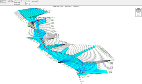
So I will check the reach lengths along that part for accuracy. The flooded water spread does, visually in the map, choke up more than I expected there so I may pretty it up although that part of the study isn’t of concern. Based on the image do you think it will change the upstream or downstream flows/flooding?
-
AuthorPosts