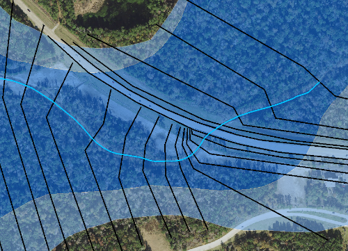
I am remapping an area across an existing bridge. The Floodway (dark blue) and floodplain (light blue) were mapped back in the 70s and do not account for the bridge. Some preliminary modeling shows that the 100yr and 500yr do not over-top the road as the maps suggest.
My question concerns the downstream x-sections. Since the stream takes a sharp turn and runs parallel to the road it makes cutting x-sections difficult. I could either cut them as shown here or create another angle at the road embankment and run each cross-section a foot or so a part.
any suggestions?
