Welcome to the RAS Solution › Forums › HEC-RAS Help › x-section geometry
- This topic has 5 replies, 1,105 voices, and was last updated 12 years, 6 months ago by drainage321.
-
AuthorPosts
-
September 19, 2013 at 6:02 pm #5369drainage321Participant
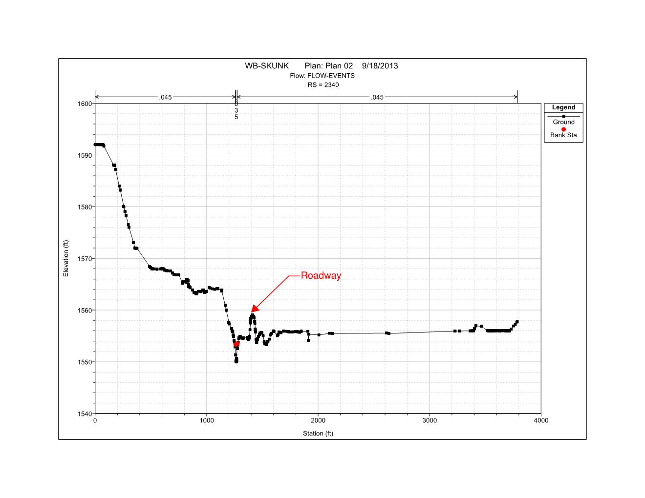
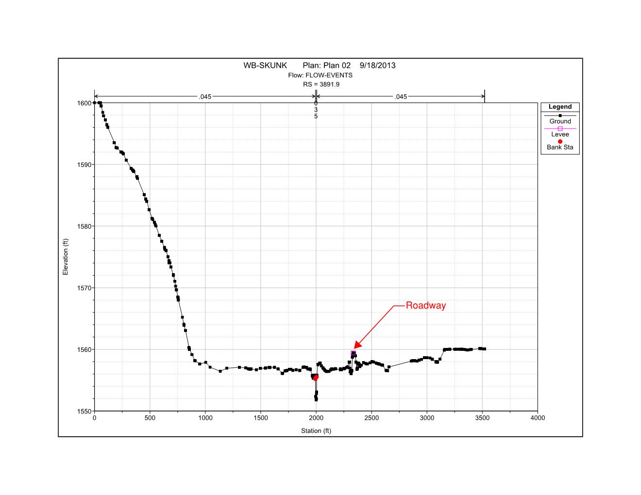
Is there a rule of thumb for the length of each section? Just getting into this project but after cutting the sections feel like i will be running into lots of obstruction, levee, ineffective area, manipulation with the sections. There will be a roadway/bridge crossing upstream of section 3812 and another roadway/bridge crossing downstream of 2340.
Images are above if they uploaded properly.
I was initially going to model the roadway as a levee but already ran into issues when the levee started approaching the downstream bridge.
Roadway low points are a couple hundred feet just to the right of each bridge.
Any thoughts/advice before I get too far into this based on the plan and sections established so far.
There are some smaller drainage ways which discharge into this creek (as seen on the sections). Is it best to just eliminate these areas and smooth out the sections or establish them as ineffective or blocked? I consistently crash when adding multiple blocked areas within the section editor.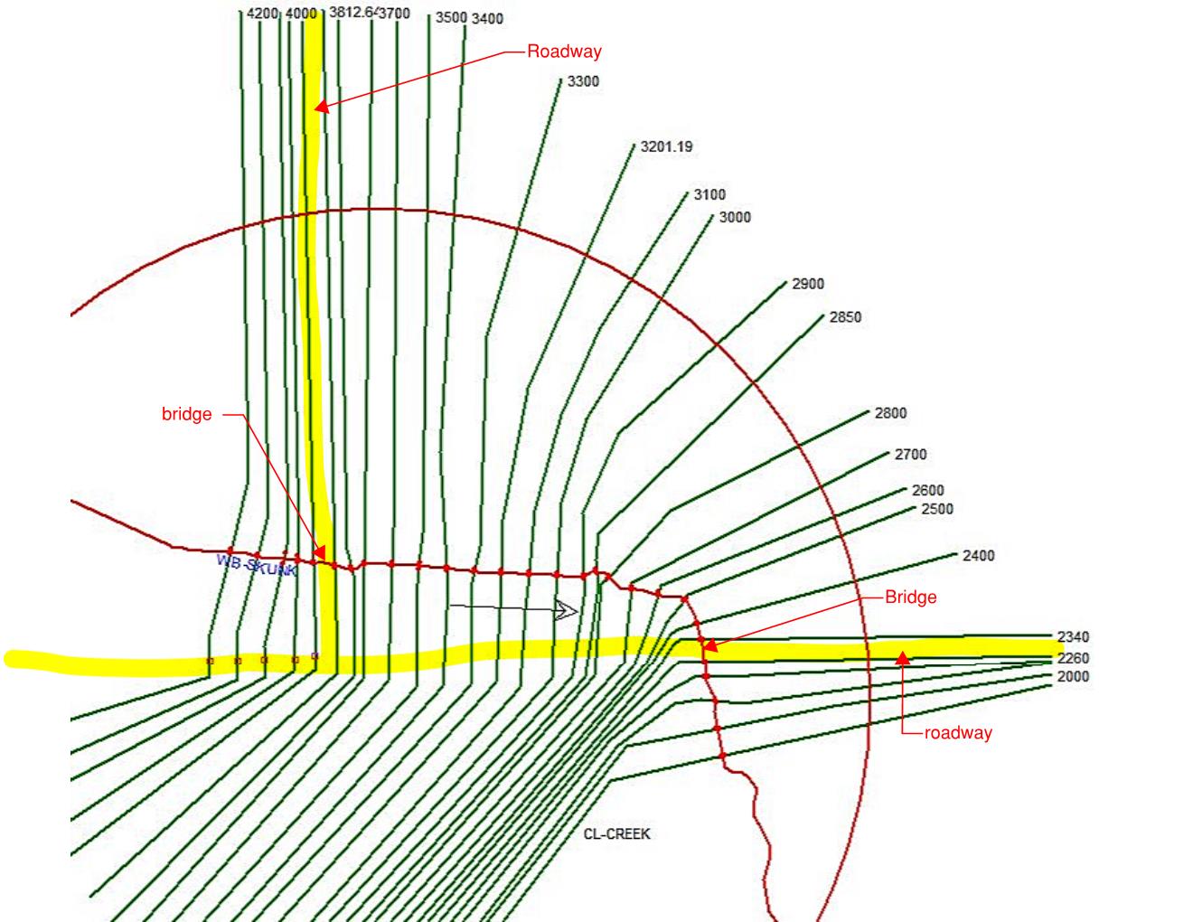
 September 19, 2013 at 9:17 pm #8599HydrojockParticipant
You ask some good questions. I’d first like to ask a couple of my own:
1) What’s the objective of the modeling? Are you trying to determine flooding extents, design the bridge, etc… The ‘best’ course of action might well depend on your objective.
2) Are you running a steady-state or unsteady-state model? (constant flow vs. a hydrograph)
3) What range of flows are you planning to model? Specifically, do you know if the flows will remain contained within the main channel? When high flows occur, do you know if the right overbank/floodplain is wet? Is it able to flow?You have the ability to ‘make’ the model behave in quite a few different ways. The more information you have about how the system is supposed to behave (have you or anyone else seen it during flood stage?) the more accurate your modeling will be.
To you specific questions:
– Length of cross section is widely dependent on what you’re trying to model. In general, make the cross section wide enough to fully contain whatever flow event you’re modeling. If the flow is contained within your roadway/levee, then the right overbank beyond the roadway is really not necessary, etc…
– Approaching the roadway as a levee is probably fine, depending on what your objective is (see above)
– You will have to use the tools available to you within the model to ‘train’ the flow as it approaches and flows through/around/over the bridges. Ineffective flow definitions are key to accomplishing this properly. See the User’s Manual for a good description of how they should be properly employed.
– The additional drainages that flow into the main channel through your study reach can probably be ignored, depending on what you’re attempting to model, of course. Is it reasonable to assume co-incident peaks for the drainages? If so, you might need to look at adding their flow to the model, etc. As to the geometry of the drainage channels, you can probably ignore them. (again, it depends on what you’re modeling…)
– Finally, I’m not sure what to make of RAS crashing when you try to use multiple blocks of ineffective flow. That’s pretty odd. Is it the program (RAS) that crashes or the entire OS? Perhaps try re-installing RAS.Hope this is helpful. Let me/us know how it goes!
JamesSeptember 19, 2013 at 9:41 pm #8600drainage321ParticipantSome answers:
1) Modeling existing conditions to size a new bridge
2) Steady state – developed flows utilizing the regression equation as there are no applicable rain gauging stations on the reach
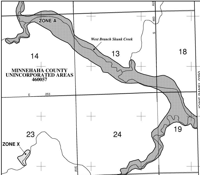
3) I’ll be modeling flow up to the 500 year event. The creek/channel itself will contain up to the 2-year (normal flow) event. everything above that is conveyed within the overbanks. I’ve attached a floodplain map. Just based on seeing the sight – I would say the floodplain on the right of the channel is wider than what is shown on the map. Section 13 to 18 to 19 for reference.– The 500 will most likely overtop the parallel roadways so I will keep the sections extending beyond – thanks for pointing me in the right direction on that item.
– It’s RAS that crashes. I think I found that if I try to add multiple blocks within the graphical x-section editor it crashes. If I manually enter the blocks within the normal x-section editor – it doesn’t. A lot more time consuming but I guess I have no choice.
 September 19, 2013 at 10:29 pm #8601HydrojockParticipant
Okay. Thoughts:
– If you’re going to have flow in that right overbank (beyond the roadway) you’ll need to be careful how you define your ineffective flow areas. You want to make sure that you maintain flow consistency for a given event along the entire study reach. For example, you don’t want the 50-year flood overtopping the roadway and flowing in the overbank at one section then not overtopping and flowing at the next; that’s not consistent (where did all that flow go? etc…)
– No idea why RAS would be crashing like that. It’s usually a very stable program. The installation process is pretty short, so I’d try re-installing it. Might save a bunch of time in the long run.Good luck!
JamesSeptember 19, 2013 at 11:04 pm #8602drainage321ParticipantYou nailed it! That is exactly my concern with the sections – I’ll just have to monitor and tweak until it represents the correct flow pattern. You helped me confirm what I thought I was going to have to do – I guess I was hoping for an easier way out
As long as I have your ear: Next topic – The average length of obstruction in determining the expansion reach length: The two bridge approaches average 500 ft of obstruction in relation to the floodplain map. If I calculate the expansion length, I come up with a downstream expansion length of 1,126′. Does that truly mean my downstream x-section should be located that far away – that is almost to the next bridge?
September 19, 2013 at 11:37 pm #8603HydrojockParticipant
If I calculate the expansion length, I come up with a downstream expansion length of 1,126′. Does that truly mean my downstream x-section should be located that far away – that is almost to the next bridge?
That’s a long way between cross sections, as you note, which probably violates the gradually varied flow assumption built into RAS. This is a common issue, especially with wide floodplains. The best way to handle it is to use additional cross sections within the contraction/expansion zones to keep the d/s reach lengths reasonable. Just be careful how you define your ineffective flow areas (gradually contracting/expanding as you move towards/away from the bridge) and set your expansion/contraction coefficients properly.
-
AuthorPosts
- You must be logged in to reply to this topic.