Hello everyone.
I’m modelling completely in 2D to simulate the path the water flows through a merely flat terrain. This terrain contains some depressions, that simulate ditches and ponds. Now I find in the results that some amounts off water, when it reaches a trench or pond, will completely disappear. Can someone help me understand what happens here?
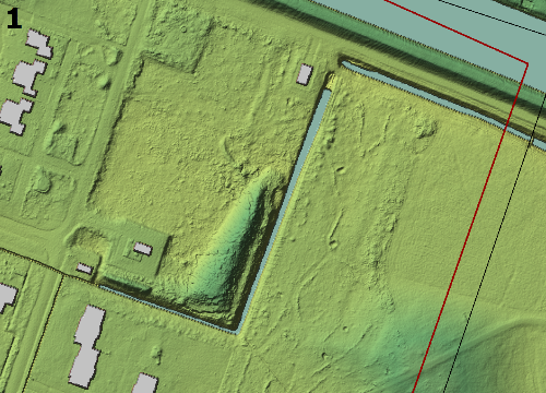
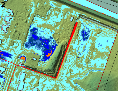
For the model I made a terrain-layer as you can see in picture 1. The input consists of precipitation at the flow area. So far so good. When the rain falls you can see the water accumulating in the depressions and flowing to the depressions from the higher terrain. (picture 2). At some point you can see that the water connects different depressions and makes “contact” with a depression that has a boundary condition (I used normal depth as boundary condition), picture 3. Here I understand that the next time step the water is divided over all the connected depressions and therefore a bit shallower in the following time step. The next time step(s) is what I can’t understand; All the water that in the previous time step was in these depressions is suddenly gone. (see picture 4). My question is about the water that was in the depressions before the “contact” with the ditches. This water can only leave the depression if there is some siphoning going on, which is not actual possible in this case.
Thank you for your time!
Some more details about the model:
I use HecRAS 5.0.5 and work with SI units.
My terrain layer has a cell size of 0.5×0.5 m, where my flow area has a grid size of 1x1m. The precipitation is a total of 140 mm in about 2 hours. The flow area is completely surround by boundary conditions with a normal depth that has a value that has been determined experimentally. The computation settings are all set to 10 minutes, except for the computation interval which is set to 5 minutes.

