I am trying to create a flood model of a river that causes overland flooding into the valley that it resides in.
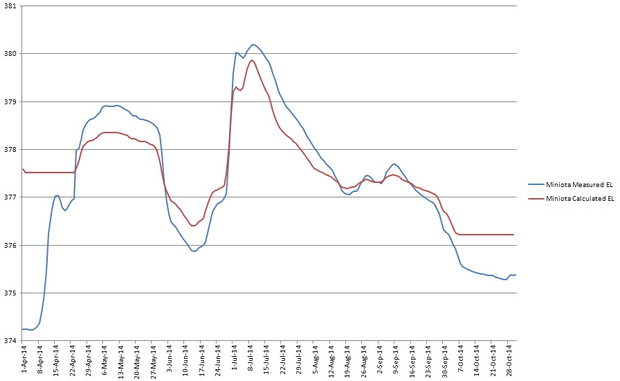
Just looking for suggestions on how to calibrate the river model, specifically for high flow situations… The first image shows the WSEL is being calculated too low at high flows, and too high at low flows.
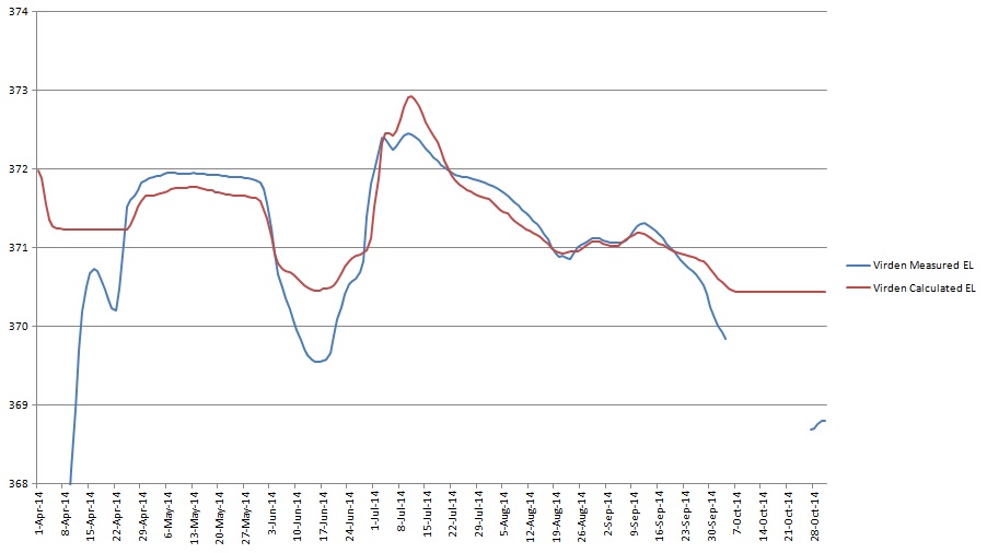
The second image which is downstream is a bit closer to the measured values, though at low flows is very far from accurate.
Ignore the first part of the graph, as I’m running high flow numbers due to stability issues.
Elevation is Meters ASL.
It seems that increasing the manning coefficient has negligible results at this point – any suggestions on what else can be done?
Thanks.