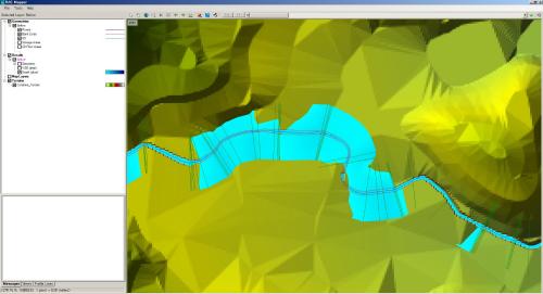
I’ve built a 1D HEC-RAS file, simulated and visualized it on RAS mapper as below figure.
And then I make depth of water in result map (Because, I want to see the flood plain of my river). But, the end part of depth (flood plain) is stopped at the end of XS line. What I expect is flood plain propagates until it meets more higher elevation in DEM (terrain).
But the problem is my target reaches are more than 2 hundreds. Moreover, I have no information about past flood plain extends. So, I maybe extend XS enoughly as much as possible.
In this situdation, is there any way to extend cross-section easilly instead of manually stretching them?
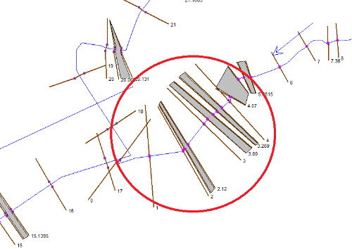
You can’t just drag the ends of the cross-section, you need to resample them from the terrain file. It also looks like the xs aren’t geospatial but are just perpendicular to the channel centerline?
You sometimes have to close and reopen RAS to get the graphics to update.