i Am running an unsteady 2D model seperated by a weir as DAM (storage and flow area). i am getting the below message as error please help me on how to go about adjusting the weir profile stationing or the centerline GIS data.
Thank you
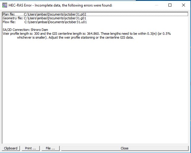
This is the exact error message:
HEC-RAS Error – Incomplete data, the following errors were found:
Plan file: C:\Users\ambas\Documents\october31.p02
Geometry file: C:\Users\ambas\Documents\october31.g01
Flow file: C:\Users\ambas\Documents\october31.u01
SA/2D Connection: Shiroro Dam
Weir profile length is: 300 and the GIS centerline length is: 364.860. These lengths need to be within 0.3(m) (or 0.5%
whichever is smaller). Adjust the weir profile stationing or the centerline GIS data.