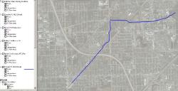
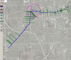
I am having a problem where RASMapper is not plotting the cross sections in a geometry file. The river shows up just fine in the correct location. The cross sections do not show up. The cross sections display correctly in the Geometry Editor window. All of the cross sections are geo-referenced. This happens in two geometry files in the HEC-RAS project. The other four geometry files plot the river, cross sections, and storage areas correctly.
Here is a screen shot of the Geometry Window.
Here is a screen shot ofr the RASmapper window.
This project started in RAS 4.1 and was imported into RAS 5.0.3. The plan file referencing this geometry file runs fine. You can see the water surface elevations in the cross section and profile plots in RAS.
Any ideas on what is going wrong. I have tried deleting the HDF file associated with the geometry. Doesn’t change what is displayed.

