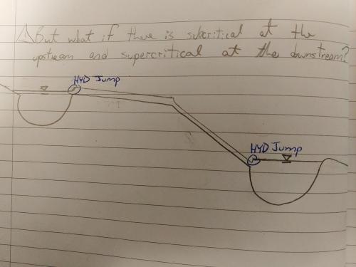
To address the figure which is my question…
For HEC-RAS to compute a subcritical flow profile, it takes a downstream boundary condition(eg. mild reach backwater into pond). For HEC-RAS to compute a supercritical flow profile, it takes an upstream boundary condition (eg. steep reach drawdown from pond).
All well and good.
BUT
What if there is a hydraulic jump exiting the upper pond, and a hydraulic jump entering the lower pond? How would HEC-RAS find a place to start computing water surface elevations?
How should the modeller approach this situation?
Thank-you,
Oscar M
