Viewing 4 posts - 1 through 4 (of 4 total)
  • Author
    Posts
  • #6520
    Briseis04
    Participant

    Good day.

    I am currently modelling the river (see picture below) but I am having a hard time dealing with the result. The flood water just fill up to the edge of my cutlines. I am dealing with the manning’s n values but I still have the same results. And changing values for my manning’s is hard since there are instances that it will have an error.

    Is there any way that the flood waters will be within the river channel? Are there other things I should be adjusting ?

    #10692
    cameron
    Participant

    What do the results look like in the cross-section? Do they extend to the edge of the cross-sections?

    #10693
    Briseis04
    Participant

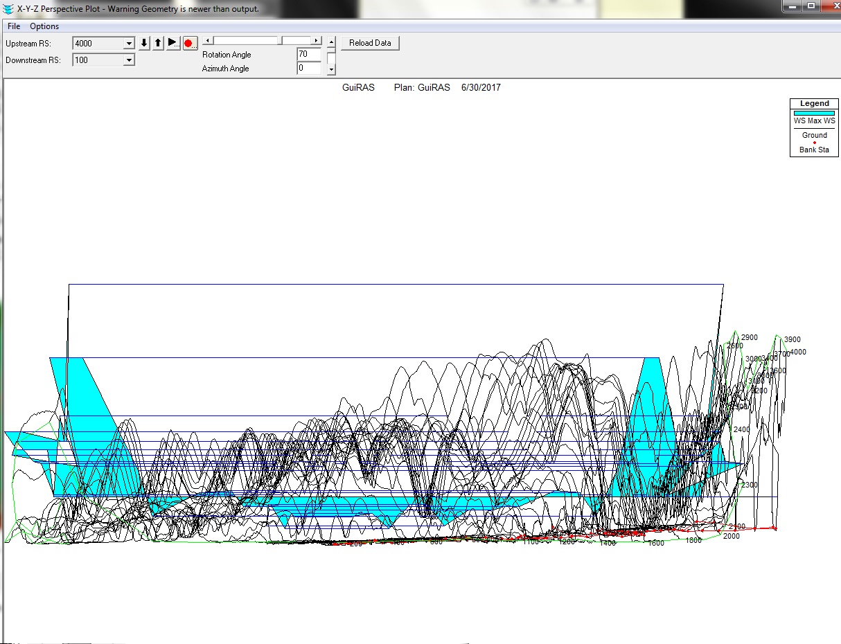
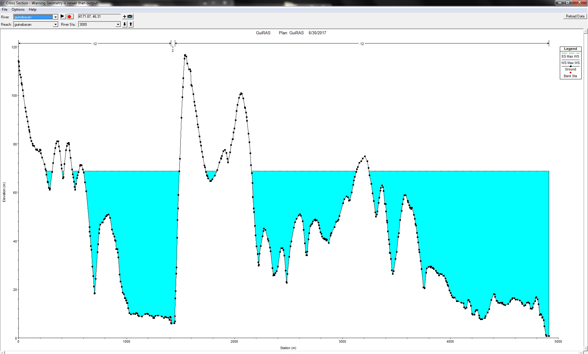
    The image shows one cross section. I am trying to control the flow of water to just be within the channel of the river by editing the manning’s n. But none of it work. maybe there are other parameters that you may suggest that I apply in the process?

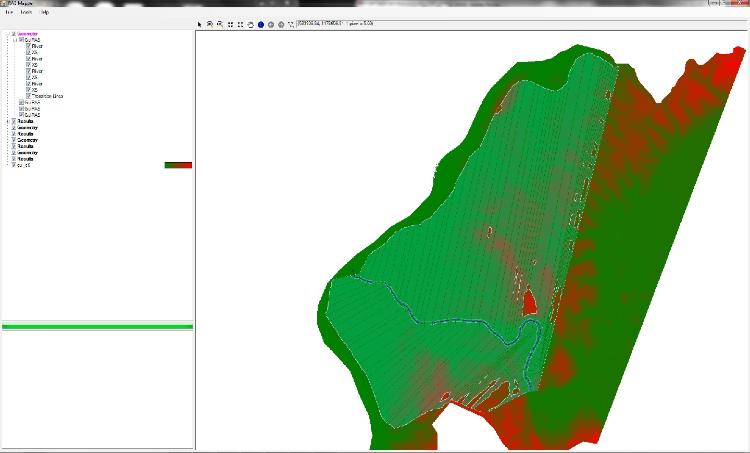
    The image below is another problem. I have encountered it with three rivers and still I don’t know what to do about it. I thought It had something to do with my arcmap while making the xscutlines but I performed the HEC_GeoRAS again twice but the results are still the same ( see picture below). I am thinking that maybe if the problem above is solved, the problem seen in picture below is also solved.


    #10694
    cameron
    Participant

    What is your inflow and downstream boundary? Based on your cross-section plot, you must have a ton of water coming in or the downstream boundary is controlling the wse. Do the reach lengths between the cross-sections make sense? Did you think about adding levees to force the water to stay where it should go?

Viewing 4 posts - 1 through 4 (of 4 total)
  • You must be logged in to reply to this topic.