Welcome to the RAS Solution Forums HEC-RAS Help Multiple Reaches unconnected

Viewing 3 posts - 1 through 3 (of 3 total)
  • Author
    Posts
  • #7768
    godzilla
    Participant

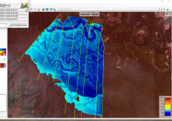
    In the attached image you can see the river at the top with a reach drawn and sections. The floodplain areas to the south have a few deepish flow paths (one has a bayou name) that connect to the river at some point downstream. We are concerned with the road that floods running north to south and has culverts at various points. I would like to create reaches for four of these flow paths so I can model the culverts. Will HEC-RAS allow this or would they need to connect to the main river reach?
    #12955
    cameron
    Participant

    Can you model this in 2D? That would be the easiest option.

    #12956
    godzilla
    Participant

    I thought I would do a 1D for the prelim and 2D for the final. I have never done a 2D but I followed the latest Modeler’s Manual and created a 2D geometry. I am only doing a small portion of a large river system. The only question for me would be the Hyrdograph that rains on the mesh. Can create a hydrograph for the various year storms. I will read up a little more. The main objective of the study is to get the velocity and water surface elevation in the floodplain (6500′ wide) where there are culverts under a gravel road that winds perpendicular to the river. I read where 2D would be better for a very flat surface.
    I put in a request to my boss to do the upcoming online 1D – 2D class.
    Thank you for answering.

Viewing 3 posts - 1 through 3 (of 3 total)
  • You must be logged in to reply to this topic.