Welcome to the RAS Solution Forums HEC-RAS Help Modeling Bridges over Reservoirs or Lakes

Viewing 2 posts - 1 through 2 (of 2 total)
  • Author
    Posts
  • #6500
    tlarsen_21
    Participant

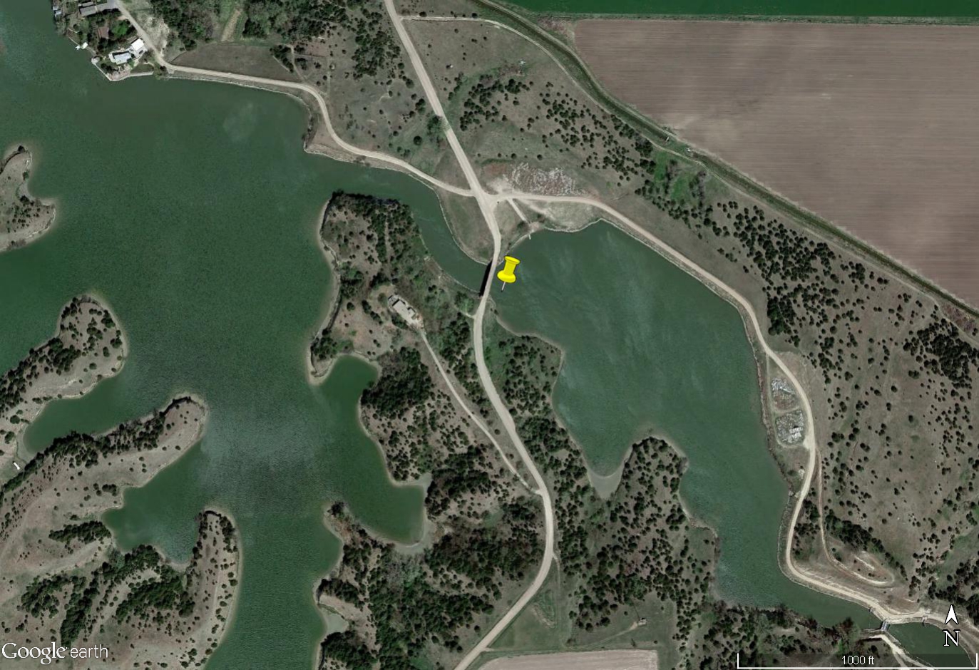
    Does anyone have any experience modeling bridges over reservoirs or lakes using HEC-RAS? We have a proposed bridge project located over a narrow section of a dammed reservoir which is shown as Zone A in the FEMA floodplain maps. We need to confirm that we are not causing more than a 1′ rise in the 100YR event per standard Zone A guidance. Wondering what special approach should be used to model conveyance through a bridge located over a lake using HEC-RAS. Is HEC-RAS even the appropriate model to use? Please let me know if anyone has any experience with this – Thank You!

    See attached aerial image:

    #10643
    Anonymous
    Guest

    HEC-RAS can be used to model a bridge over a lake. The approach to setting up the geometry is essentially the same as for modeling a bridge over a river. One potential issue is the availability of lake bathymetry to define the wetted portions of the cross-sections upstream and downstream of the bridge. Assuming you have that data, the cross-sections just need to be located in a manner to properly define the expansion/contraction of flow into and out of the narrow channel where the bridge is located as well as through the bridge itself. Also, the model should be extended far enough downstream to include the dam and any other constrictions that could impact tailwater elevations at the bridge.

Viewing 2 posts - 1 through 2 (of 2 total)
  • You must be logged in to reply to this topic.