Welcome to the RAS Solution Forums HEC-RAS Help Lateral Strucutres in HEC-GEORAS

Viewing 2 posts - 1 through 2 (of 2 total)
  • Author
    Posts
  • #5404
    dpender
    Participant

    Hi,

    I am modelling a small meandering UK river and defining parts of the floodplains as storage areas with lateral structures. I am creating the model using HEC-GEORAS.

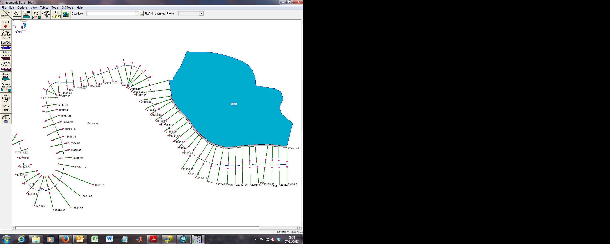
    I seem to have come across and issue regarding the length of the structure. When I import the created model data into HEC-RAS the strucutre stops short of the downstream section to which I digitised it in ArcGIS. See attached figure. It should extend to the end of the storage area.

    Is this due to the length being defined by the river centreline or something? Any ideas how to fix this?

    Thanks,

    Doug

    #8641
    Hydrojock
    Participant

    Doug,


    Is this due to the length being defined by the river centreline or something? Any ideas how to fix this?

    Sort of. It has to do with the difference in downstream reach lengths in the overbanks versus the true length of the lateral weir. The User’s Manual actually has a very good description of this and how to ‘fix’ it. See page 6-80 or so. Basically, you can manually enter the correlation between river stationing and lateral weir stationing. It’s done in the Weir/Embankment Editor.

Viewing 2 posts - 1 through 2 (of 2 total)
  • You must be logged in to reply to this topic.