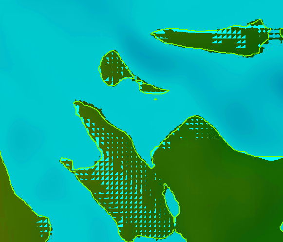
In RASMapper, what’s going on with the partially filled (triangle-looking blue shapes) cells outside of the inundation boundary? The green line represents the inundation boundary. The mesh is Cartesian (square) in this area.
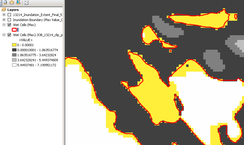
I also noticed that when you make a “Wet Cells” polygon shapefile (shown in red below) with threshold depth of 0, it does not include these partially filled cells. However, if you create a raster file based on terrain, they are included, but have a value of 0.000000 (6 zeros, shown in yellow). What’s going on in these cells? Do they have a non-zero depth that is getting truncated during raster creation? They must be wetting at some point to be included in the “wet cells” raster, but why wouldn’t they show up in a “wet cells” polygon or in the inundation boundary?
Why are these cells not included in the inundation boundary or “wet cell” map? I could understand not including them if they have very, very low values near the inundation boundary, but they extend 100s of feet from boundary and that is confusing to me.