Hello
I’m using HEC-RAS 5.0.5, 2D simulation of a flood event.
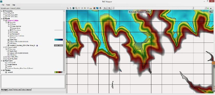
HEC-RAS 5.0 manual says that “Inundation boundary” is a line extracted from depth map (max) where depth = 0.
But the inundation boundary that I get is quite different from the limits of the depth map. The “inundation boundary” is going uphill in some reservoir branches, such as in the picture attached, even though “depth (max)” and “WSE (max)” gives a nearly horizontal plane in this area, as one would expect in an area of almost zero velocities.
In the picture, it can be seen that the inundation boundary (black line) goes from yellow to red in terrain colours, meaning it goes 5 meters uphill.
I did not find any explanation for this in the manual or in this forum.
Any insight is welcome.
Márcio