I am having some weird projection issue it seems like….I’ve tried 5.0 and 4.1, same issue.
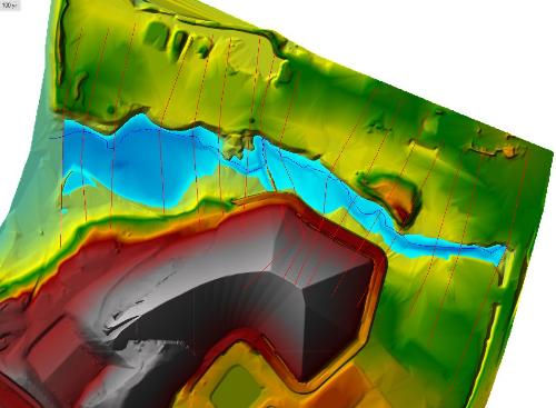
So I have a 3D surface in AutoCAD Civil 3D 2016 that is set to a global coordinate system (VA83-SF) from which I pull an alignment from for the stream centerline and sample lines for the stream XSs. I use the “Export to HEC-RAS” function in CAD and the geometry comes in fine into HEC-RAS. I then take my surface from CAD and “Export to DEM” to bring it into RAS Mapper as a terrain. That works fine too.
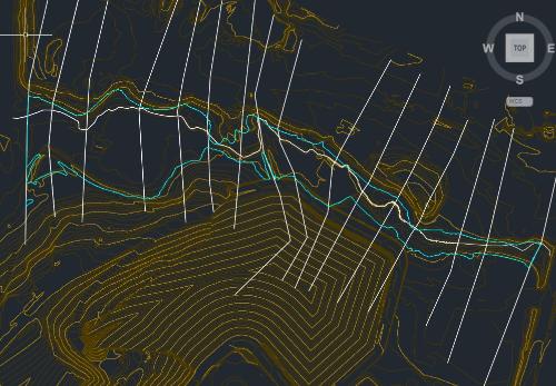
Once I compute and plot the inundation boundary shape in RAS Mapper (after setting SRS to VA83-SF), it lines up perfectly with the XSs and DEM terrain I brought in from CAD but is shifted off from the centerline (pictured). Then when I export the inundation boundary as a .shp file and bring it into CAD, it is also shifted from the CAD surface, even though it still lines up with the XSs.
This distance the shape is off is about 13 feet, which is also the difference between international and U.S. feet for my project location. The weird thing is that everything is already in U.S. feet, but if I reproject to Intl Feet, it goes in the opposite direction that I want it to.
Has anyone ever had any shifting errors like this between CAD and HEC-RAS? I’ve been all over google looking for an answer to no avail. Maybe I’m not using the right terminology…