Welcome to the RAS Solution › Forums › HEC-RAS Help › Hec-Ras 2d very basci modelling
- This topic has 9 replies, 305 voices, and was last updated 6 years, 7 months ago by GB91.
-
AuthorPosts
-
July 8, 2019 at 12:43 am #7352GB91Participant
Hello everyone, nice too meet you.
my name is Giovanni and i’m a young italian hydraulic engineer.
At first, sorry for my bad English.I tried to perform a very simple 2d simulation with Hec-ras 5.0.7.
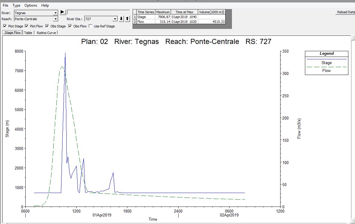
I dowloaded Dtm from my National site, i draw 2d flow area and insert boundery conditioni upstream and dowastream. For downstream i put normal depth, for upstream i put a flow hydrograph.The problem is that: when i start the simulation, the program returns to me values of water leavel completly out of range (50 meters or more) for very small value of discahrge.
I tried differt solution, change Manning values, chage location of boundery section…but i have the same problem.what am I doing wrong?
Thaks all who answer me.
Bye
July 8, 2019 at 2:08 am #12355ckatsoulasParticipantcan you send a picture of what the model looks like and the results
July 8, 2019 at 2:18 am #12356GB91ParticipantAt first, thank you for the replay, ckatsoulas.
Now i’m traing to perform an unsteady flow analysis in 1d dimension and there is the same problem.
With steady flow data the depth of water is correct…when i put unsteady flow data with hydrograh there is the problem.
It can be possibile that i must change my computer’s languages to english to perform the correct simulation?
That problem seems to be a problem of unit system or something else….Have you any solutions?
Thankyuou
July 8, 2019 at 2:27 am #12357GB91ParticipantI noticed that there are some sections at dowstream that have a Q Total much more grater that the maximum flow in input. How it can be possibile?
July 8, 2019 at 3:19 am #12358GB91ParticipantJuly 9, 2019 at 2:03 am #12362Scott MillerParticipantHi Giovanni. Take a look at this blog post to improve your unsteady model. I found the Brunner paper to be especially helpful.
General tips to stabilize the model would be to decrease the time step and distance between cross sections. Check to see if there is a reasonable Courant number for the distance and time step in the model. Try to step through output intervals and look at what happens in profile view to locate where problems are.
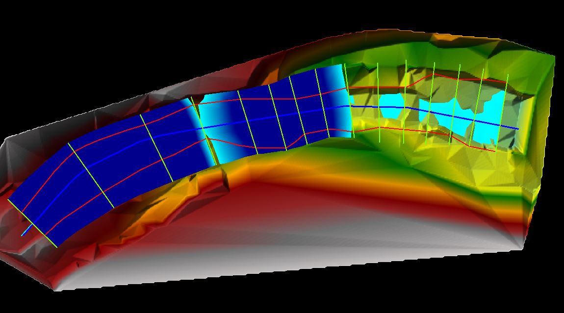
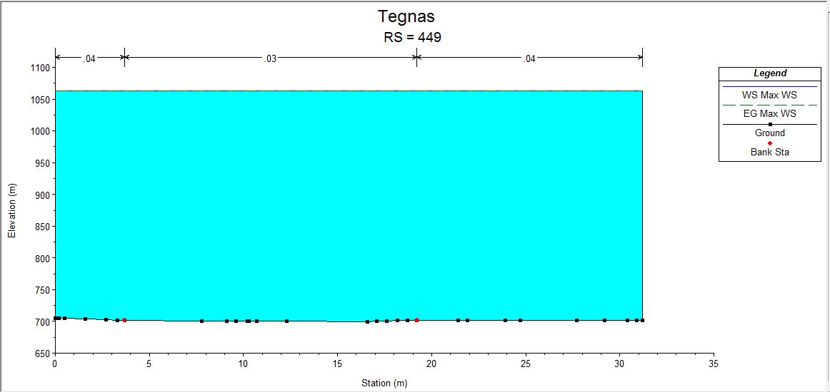
July 9, 2019 at 2:43 am #12359ckatsoulasParticipantI’m having trouble viewing the pictures because the forum doesn’t allow me to pan across. Are you sure you’re not having issues with the units. Are you using feet or meters? Also the picture below is showing cross sections so it’s not really a 2D model but a 1D model. how did you create the cross sections? did you extract them from the terrain?
July 9, 2019 at 3:00 am #12363GB91ParticipantHello Scott Miller and thank you for the aswer.
I tried to reduce the time step interval and add more XS cross section but the problem still the same.I suppouse there are problems in the up stream boundery conditions because in the end of the area i have to analayzed the water level is quite good….but at the beginnig, near the upstream boundary conditions there are problem.
I only put an simple hydrograph of a 100year discharge. Also, when i animate the process in the RasMapper, the input flow seems to be variable…How can be possibile?
July 9, 2019 at 3:04 am #12360GB91ParticipantHello ckatsoulas,
At the first tiime, when i see the results, i suppouse that there are problem with units or something else…but i use SI (units system) and put input file in metres and mc/s.
Yes, at first i tried a 2d modelling simulation. After that i tried a 1d modelling and i extracted the cross section from terrain into ras mapper.
Also in 1d simulation i have the same problem. Depth of water very high compare to cross section deepth.What can i do?
July 11, 2019 at 2:03 am #12361ckatsoulasParticipantcan you post your 2D model showing the grid and boundary condition lines you used
-
AuthorPosts
- You must be logged in to reply to this topic.


