Viewing 2 posts - 1 through 2 (of 2 total)
  • Author
    Posts
  • #7741
    mlc3n3
    Participant

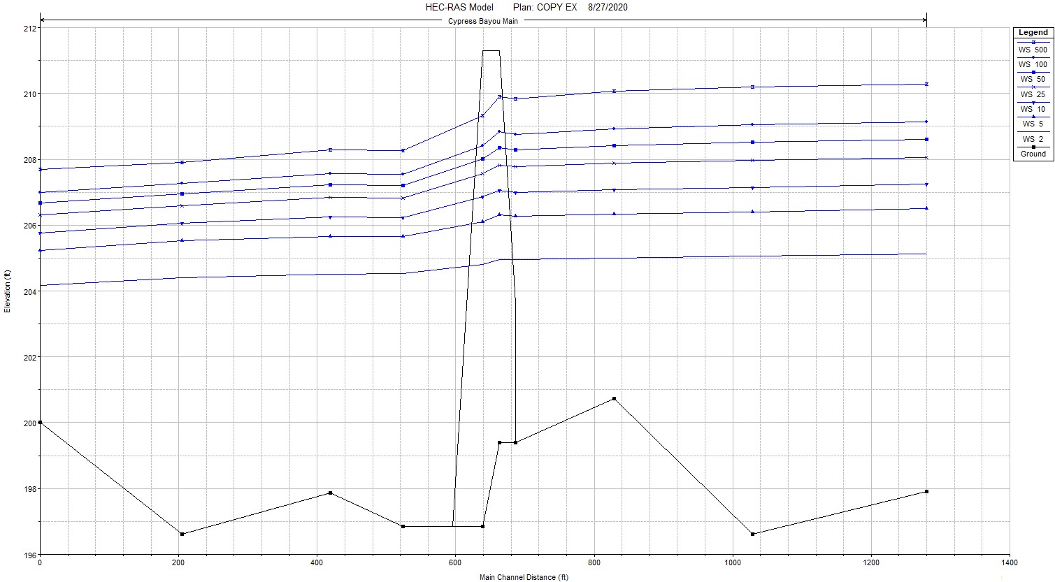
    Consider the ground elevation points of the xsecs and profile below. Should I be concerned?

    Project context:

    This bridge and hydraulic model is literally a swamp. It’s Cypress Bayou in AR, USA. So, the thalweg or CL of the river reach crosses over high and low spots. I have manual calculated and entered the slope for a normal depth boundary condition. Obviously HECRAS will still use these elevation points in xsecs, but will the program use these slopes?

    #12926
    Jarvus
    Participant

    I don’t think there is any reason to be concerned because there is an adverse slope where the ground gets higher as you go downstream. For 1D, the exact location and depth of the invert doesn’t matter. The important thing is for a given water surface, how much area and wetted perimeter there is.

    The RAS hydraulic reference manual goes into great detail about how this is computed. Or any basic open channel text book/reference book would also.

Viewing 2 posts - 1 through 2 (of 2 total)
  • You must be logged in to reply to this topic.