Welcome to the RAS Solution Forums HEC-RAS Help GeoRAS error during floodplain delineation

Viewing 5 posts - 1 through 5 (of 5 total)
  • Author
    Posts
  • #5701
    ed
    Participant

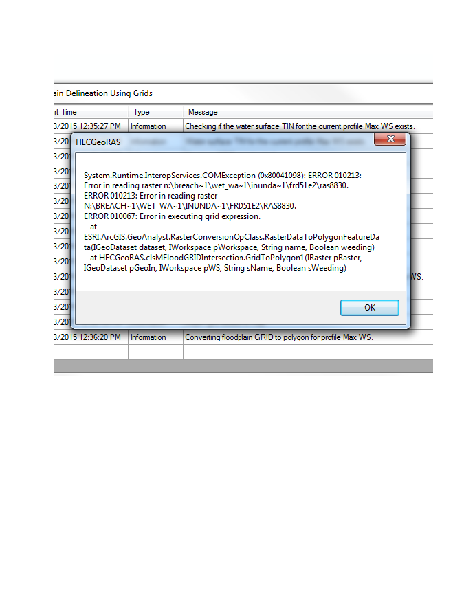
    depth is computed and shown, but get the following error message when “converting floodplain GRID to polygon for profile Max WS”. Tried to use 3dAnalyst to convert water surface tin to raster. Ran ok for 2 sites and then started giving same error message.

    #9110
    jadams
    Participant

    I have received this error when working on a network drive. Try setting the data to export to the hard drive.

    #9111
    Anonymous
    Guest

    Thanks for that suggestion, but all my work is currently on the local hard drive. I started out trying to use network drives, but too many problems arose.

    #9112
    rahulkapurkar
    Participant

    you got the solution for hec geo ras floodplain error

    #9113
    Anonymous
    Guest

    I would suggest to keep exported files locally and “avoid” putting them in sub/sub/folders. This is what worked for me- C:/rasoutput

Viewing 5 posts - 1 through 5 (of 5 total)
  • You must be logged in to reply to this topic.