Welcome to the RAS Solution › Forums › HEC-RAS Help › Flood Map
- This topic has 25 replies, 1,234 voices, and was last updated 10 years, 10 months ago by Anonymous.
-
AuthorPosts
-
April 15, 2015 at 4:15 pm #5773AnonymousGuest
Hi everyone,
I’m working on a project that involves the calculation of the 50 year flood height so what I am trying to do is create the geometry data in GEO-RAS and export it to HEC-RAS to run the model with the flow I got for that return period. I also got the mean flow. The problem I am having is when I export the data in HEC-RAS everything seems to be right but when I compute the plan the results for the WS Elev doesn’t make any sense. It’s really weird because if I put a really low flow the floodplain is completely full. Someone could shed light on this? what am I missing? I would much appreciate any help, it’s driving me crazy.
Many thanks in advance.
Laura Lozano
April 15, 2015 at 6:47 pm #9248jadamsParticipantMake sure all the fields exported out of Geo-Ras correctly. Make special note of the the downstream lengths and manning’s n values. Sometimes these will not export as anticipated or you may have forgotten the appropriate GIS fields for them to export.
April 16, 2015 at 1:06 pm #9249neeyoleParticipantThanks Jadams for your response. I put manning’s values manually and the rest of the inputs seems to be ok. The strangest thing is that there is no much difference is I put a tiny flow or a huge one. The floodplain is completely full!.
Many thanks
April 17, 2015 at 8:01 am #9250cameronParticipantwhat did you set for your downstream boundary? Is the floodplain lower than the channel (channel bounded by levees)? Maybe if you post a picture or the files it might help.
April 17, 2015 at 2:43 pm #9251neeyoleParticipantHi Cameron,
Thanks a lot for your reply.
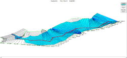
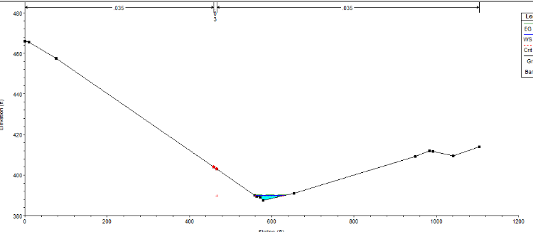
I run the program with a mixed flow regime since I got changes in the slopes. So I set a Normal Depth for upstream and dowmstrean of 0.01. I also run the program with a Critical Depth but it didn’t work either. Attached there is a snapshot of my cannel with a flow of 18.4 m3/s. But if I change the flow for the 50 year flow event (That is considerably bigger than the mean flow (594.4 m3/s) is almost the same.
Only to make sure, when you digitalize the river and Banks line as well as the flowpath in GeoRas is always from upstream to downstrem right?April 17, 2015 at 7:52 pm #9252cameronParticipantWhat do your cross-sections look like? It would be easier if you posted your files and I could take a look.
April 17, 2015 at 8:42 pm #9253neeyoleParticipantThere you go the geometry I imported with Geo-Ras and the Project in HEC-RAS. I had to modify all the Banks but I am not sure if I did it right.
Many many thanks Cameron, if I can help with something let me know.
Nueva_carpeta.zipApril 18, 2015 at 3:40 am #9254cameronParticipantThere was no geometry file attached so I imported in the Geo-RAS file. If you look at the profile, the river is going in the wrong direction. Station 100 (west end of model) should be the upstream end of the model.
April 18, 2015 at 1:47 pm #9255neeyoleParticipantI was seeing that something was wrong with the profile but I just assumed that the direccion I was told was the right one? thanks for that Cameron. Just one more thing, regarding the bank channel should I stick to the points I get when I digitalize them according to the reality or modify them in HEC-Ras?
Many thanks for your helpApril 19, 2015 at 6:23 am #9256cameronParticipantIn general I digitize them and then move them in HEC-RAS to what makes sense if it does not look correct in HEC-RAS. I also check in profile view the bank elevations to make sure they are consistent. Some people recommend placing the banks at bankfull flow which some say is around the 2 to 5-yr flood event or 20% of the 100-yr flood event.
April 19, 2015 at 5:14 pm #9257neeyoleParticipantSorry for the obviousness of the question but when you say that you check the Banks elevations in profile view to make sure they are consisten, what do you mean by consisten?
April 20, 2015 at 12:07 am #9258cameronParticipantThat the bank elevations don’t jump up or down a lot from one cross-section to the next.
April 20, 2015 at 2:18 am #9259neeyoleParticipantThanks a lot Cameron! I already redid it and it makes sense now! I just hope not to have more silly problems!
Thank you again I really appreciate your helpLaura
April 21, 2015 at 1:54 pm #9260neeyoleParticipantHi,
Just one more thing if you could. I am working on the bank lines now to make sure they are consisten and I was in doubt since accordingly Arcgis the bank point should be where the red spots are but It doesn’t make any sense. If I establish them relying on the 2-5 year flood height they will be out of the main channel. What should I do? any suggestion?
Many thanks
April 21, 2015 at 10:27 pm #9261cameronParticipantWhat is your topographic data based on? Does it have really good resolution to pick up the channel? Does the imagery line up with the topographic data?
-
AuthorPosts
- You must be logged in to reply to this topic.

