Hi,
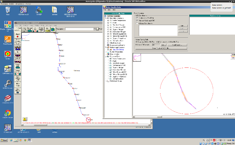
I created a hydraulic model, based on cross section data in CSV. Then I replaced the river network with one, which I exported from ArcGIS. Finally I interpolated cross sections as perpendicular segments to river reach. Steady flow simulation works well. I set up water quality simulation, however some of my WQ cells seem to have unusual shape (image attached). Could someone explain me how can I fix them?
Regards,
Marcin.