Is it possible to edit the edge lines in a way, that 2d mapping is possible outside the 1D-domain?
Every time I edit the edge lines and then compute the Stored map in RAAS mapper, the old lines at the borders of the 1D-domain re-appear …
I edit them in RAS-mapper, save the edits – but it won’t help 🙁
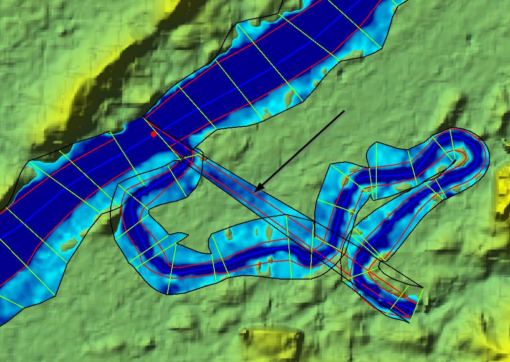
At the junctions, the edges are defined wrong (connected to the first XS of the tributary).
When I try to edit them, anyway the interpolation surfaces stay the same.
Where could I define the edges or bank lines to stay in the main river?
The floodplain is only computed to the edges (black lines).
But where the edges are defined wrong (arrow), ras mapper does the 2D-mapping with the terain in this area.
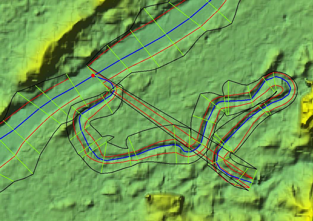
how is it possible to extend the floodplain mapping with terrain beyond the XS-extends (green lines) as I can see in this picture from a RAS-solution post:
The image you presented from the post is a 1D/2D model so the flow in the overbank is 2D.
There is not an easy way to extend the wse outside of the cross-sections. For your particular model, is appears the main channel does not contain the flow, so either extend your cross-sections, make the overbank 2D, or add a split reach.
As for near the tributary, you would need to add lateral structures so flow can spill from one cross-section to the next.