Hi,
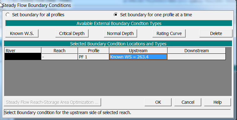
I have just discovered this forum. I am trying to model a very simple rectangular channel (spillway sluice), with a length of 14 m, a depth of 10 m and a difference in elevation of 1 m. The flow is 120 m3/s, and the upstream boundary condition is a water surface elevation, 7 m over the bottom of the channel at the upstream position.
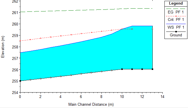
The analysis works well (no error message, supercritical flow), however when I verified the upstream boundary in the profile, it was at 4 m over the bottom of the channel at the upstream position.
I have tried to increase the upstream boundary condition of the water surface elevation up to 10 m, and the upstream boundary condition in the water profile (the graph produced by HEC-RAS) remains at 4 m.
It is as if the software was capping at 4 m. It would be appreciated if someone could help me out.
Thank you in advance