Welcome to the RAS Solution › Forums › HEC-RAS Help › Connecting 1D river with 2D flow area using a lateral structure
- This topic has 5 replies, 1,759 voices, and was last updated 9 years, 3 months ago by Anonymous.
-
AuthorPosts
-
November 1, 2016 at 6:13 pm #6243AnonymousGuest
Hi,
I am modeling a 1D river reach with a 2D representation of the overbanks, and i am having some problems connecting the 1D river with the 2D area using a lateral structure. So far, i have managed to connect one small 2D area to the 1D model, but the model was unstable and much effort had to be put into stabilizing it. I now want to connect my entire floodplain to the 1D model, and I would greatly appreciate some general advise on how to set up this type of model.
1. Can the entire river reach be connected to the 2D flow area using one, very long, lateral structure? If so, can water flow over the lateral structure in both directions simultaneously? (i.e. from the 1D to the 2D over one part of the structure and from the 2D to the 1D over another part, at the same time)
2. What is the best way to determine where to place the lateral structure if there is no well-defined levee separating the river from the overland?
3. How can one improve the stability of the lateral connection?
Thank you!
/Beatrice
November 2, 2016 at 2:08 am #10147AnonymousGuest1. Water can flow in both directions at the same time. If you are having instability problems, you might want to break up the length of the lateral structure in order to isolate the section that is having the most problems.
2. If there is no well-defined levee, it is a little arbitrary where to place it. It is generally better to place it where the velocity (in the downstream river direction) is not too high.
3.
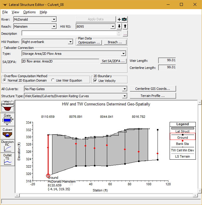
If there is no well-defined levee: Are you using RAS 5.0.3. If so, you might try using the “Normal 2D Equation” instead of the “Use Weir Equation” on the lateral structure editor.
If you haven’t already done so, turn iterations on. Go to unsteady run editor, Options, Calculation Options, 1D/2D Options and enter Maximum iterations (4~8 usually works fine).
If you are using a version prior to 5.0.3 (and/or you are using the weir equation), from the Options, Calculation editor go to General (1D Options) and enter “3” for the Lateral Structure flow stability factor and enter “3” for Weir flow submergence decay.
If you are still having stability problems, you might try using a shorter time step.
November 3, 2016 at 11:17 am #10148AnonymousGuestGreat, thank you for your answer! It seems that using “Normal 2D equation” improved the stability very much.
/Beatrice
April 6, 2018 at 12:31 pm #10149user16ParticipantCan you p[lease help me with this error.
– The river station does not agree with the geospatial centerline data.
The river station for this lateral structure places it between XS’s ‘9670.347’ and ‘8290.706’
The start of the centerline places it below XS at ‘8290.706’Please explain me what is it and how to solve it.
April 6, 2018 at 4:51 pm #10150AnonymousGuestMost likely, you need to re-georeference you lateral structure centerline or recut it.
April 6, 2018 at 9:27 pm #10151Scott MillerParticipantChange the name of the lateral structure to some thing like ‘9665’ or ‘9670.1’. So long as it is between ‘9670.347’ and ‘8290.706’. The “name” tells RAS where your lateral structure is.
The stationing on your lateral structure increases going downstream starting from zero somewhere between those cross sections. Interpolating cross sections after creating a lateral structure may have changed what you need to name the lateral structure.
— more —
Indicate the actual distance to the upstream cross-section in the Lateral Weir Embankment window. You can create the embankment with an arbitrary distance first, then close the window read the actual distance in the Lateral Structure Editor. Reopen the Lateral Weir Embankment window and enter the distance you read as a positive value.
-
AuthorPosts
- You must be logged in to reply to this topic.
