This is more of a GIS question but since it is for RAS and I can’t find info on GIS sites, I will ask here. I am trying to lift the terrain (raster data based on LiDAR) to reflect buildings as obstructions for my RAS model. This is for a dam breach model and there are only a few buildings. I have done the following:
Create Feature
-created as a polygon and drew in building shape
Add Surface Information
-added area and Zmax,
-set Zmaz to a height of 12 ft corresponding to the building height
Feature to Raster
Mosaic to New Raster
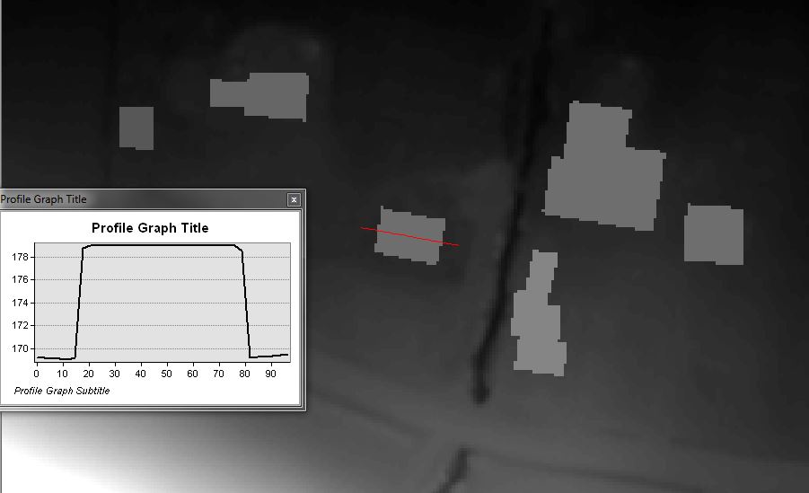
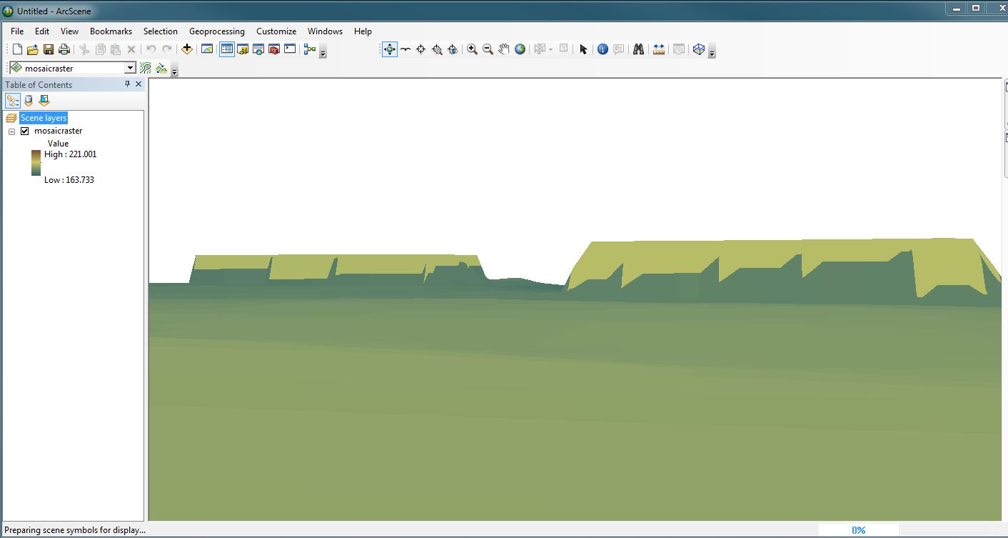
The problem is that the edges of the buildings are jagged and sloping (see images below) b/c of the cell size (set by the raster from LiDAR).
Is there anything that I can do to fix this? Does it matter? Or is there a better way of lifting the terrain?
If I reduce the cell size when creating the mosaicked raster, the output raster is jagged in several areas and from what I understand, you should not change the cell size of your terrain raster.

