Dear modellers,
I try to model the overflowing of a river at the level of its debris cone. For this purpose I run a 1D model.
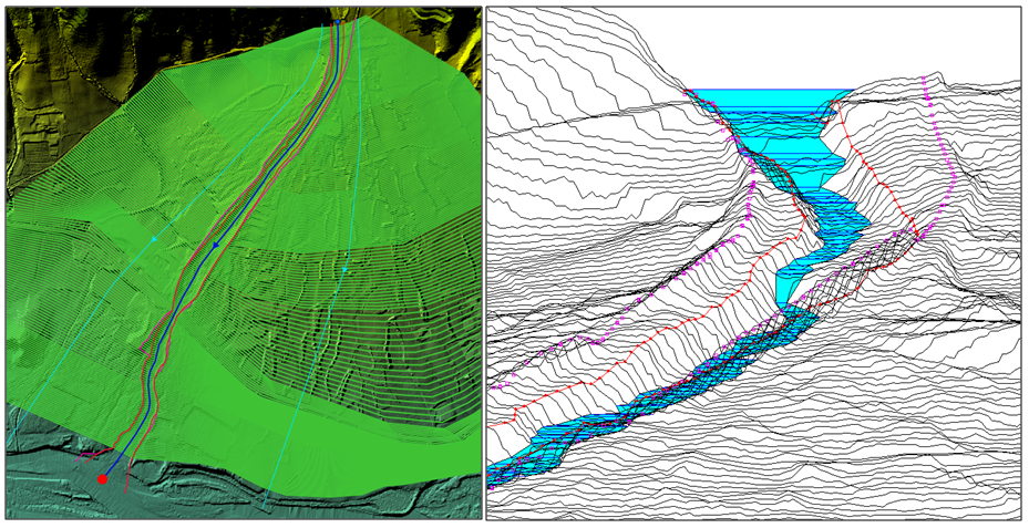
I extracted cross profiles from a DEM raster using RiverGIS (QGIS plugin) as can be seen on the following figure. The distance separating the cross profiles in the river channel is 5 m. After importing my geometry in RAS, I reduced to 450 the number of points in each cross profile using the Minimize Area Change method of the cross section points filter tool.
As the bottom of the river that I am modelling is generally higher than the bottom of the valley, I defined left an right levees for each cross section to force the water to stay inside of the river until it will overflow.
My upstream input is a flow hydrogrpaph (constant increase during 1.5h, then constant inflow of 9 m3/s during 1h, then constant decrease during 1.5h until 0 again). I also added a minimum flow of 0.01 m3/s to keep the model stable. I indicated the slope of the river (normal depth) as downstream condition.
When it comes to the computational parameters, I indicated a computational interval of 1 sec and 5 min for the other inputs. I also enabled the mixed flow regime (1D) to make the model more stable.
My model runs in less than 2 min and my WSEL error is 2.182 m.
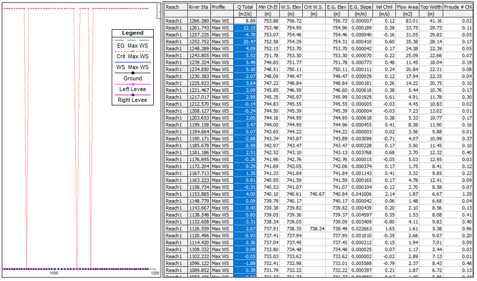
For some reason, the model seems to be unstable, as for most of my cross profiles the critical depth elevation (EG Max WS) value tends to infinity (see figure) and in the profile output table the total discharge is not equal to 9 m3/s (mostly near to 0 or even negative ?).
Thank you in advance for your wise advice.
Best,


