Full Momentum Episode 37: All Things Gates
Gates play a crucial role in hydraulic modeling, impacting water flow, flood control, and dam operations.
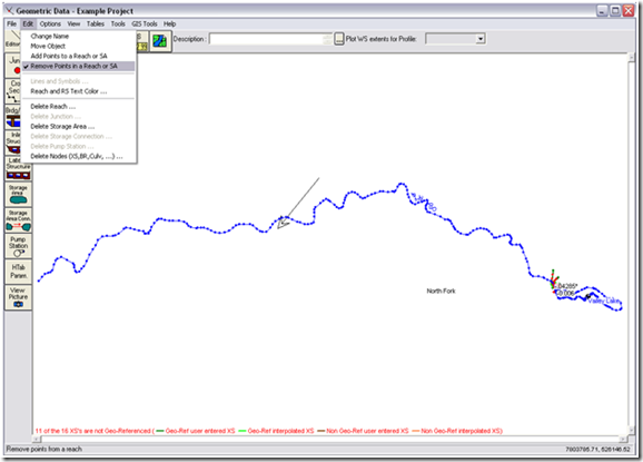
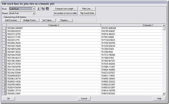
Editing the positioning of your geometry in HEC-RAS can sometimes be a pain, especially with large systems. This tip will show you how to quickly (and easily!) remove sections of a reach. If you import reach stream lines through ArcGIS, or a similar program, your schematic may look similar to the figure below.  In this example I want to remove a large section of the reach, and the method of clicking each node to would be very time tedious and consuming. Manual edits can be useful for editing small portions of a reach or storage area, but not for hundreds or thousands of points! Instead, navigate to Reach Invert Lines Table … under GIS Tools in the Geometry window. This will bring up a table of all the points in the reach, which are organized by XY coordinates. From here you can remove or edit a large portion of points. XY coordinates are shown in the bottom-right corner of the Geometry window when hovering the mouse around the area you are interested in.
Comments
Anonymous
on June 7, 2016I just create a temporary reach connected to a point in which I want to break my true river. When junction is created, river divided into two section is made. Next you just have to delete both: your temporary river and unwanted section. It's a trick for lazy people. 😉
Take care,
Kinga
Anonymous
on February 7, 2017Thanks
Add Your Comment