Creating Static Results Maps (Shapefiles or Rasters) using RAS Mapper
Written by Chris Goodell | October 19, 2016
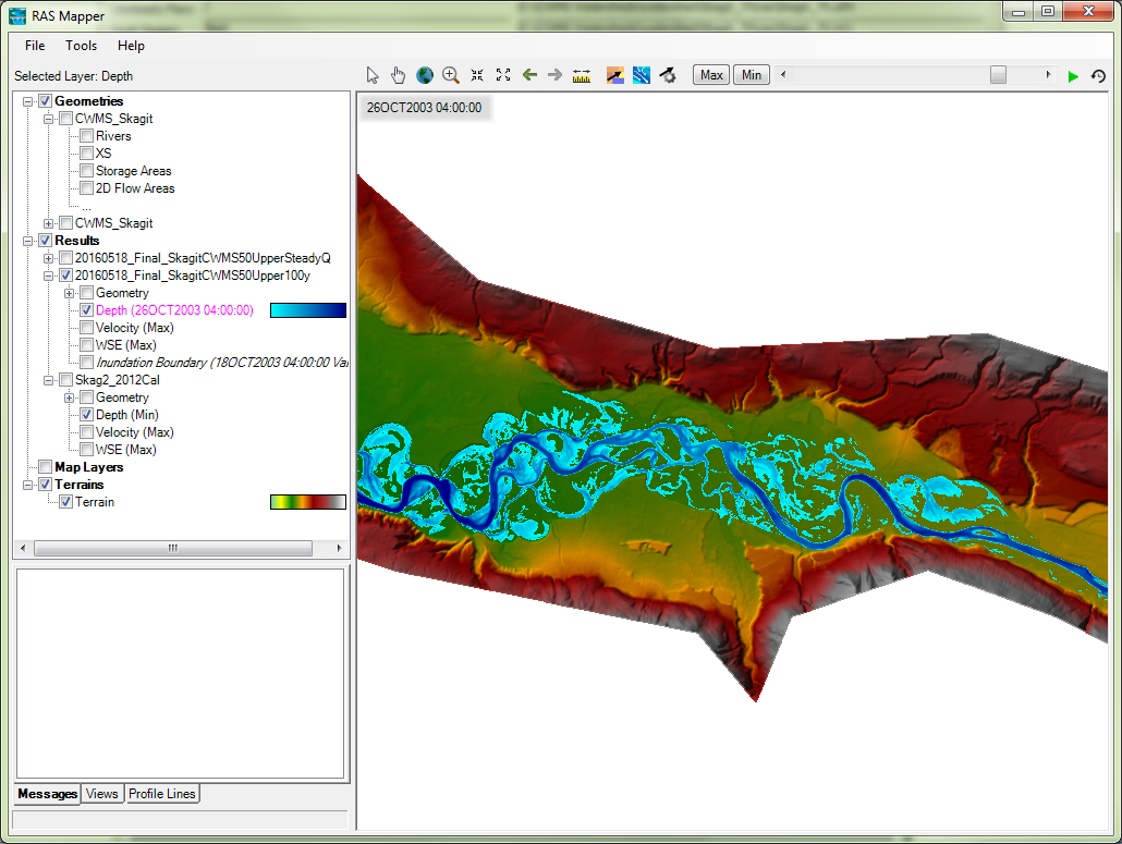
Many readers have been asking how to create shapefiles and other static maps in RAS Mapper. One of the main differences between RAS Mapper in RAS 4.1 and RAS 5.0 is the existence of Dynamic Maps. What makes these maps dynamic is that when you have that Results Layer selected in RAS Mapper, you can use the slider bar (top right) to animate through the simulation and see the results of that layer at each mapping output interval (or each profile for steady flow models). These maps are not saved to the disk, they are temporarily stored in memory.
With this change, you can no longer “Export Layer to Shapefile” as you could previously, due to the fact that these dynamic layers are not one map, they are many maps.
To create static maps, such as shapefiles or rasters, we must first tell RAS Mapper what type of static map we want (Inundation Boundary, Velocity, Shear Stress, etc.) and whether we want the data from a specific timestep, or max/min. To do this, right click on the bold “Results” heading in the Layer Manager in RAS Mapper, then choose “Manage Results Maps”. All of your plans and default layers will load (like below):
Choose the plan you are interested in, and click on “Add New Map.”
If you’re running a Steady model, the window that pops up will look like this:
If you’re running an Unsteady model, the window that pops up will look like this:
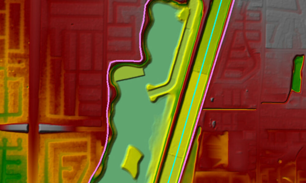
Choose the Map Type you are interested in creating; in this case we are creating a maximum Inundation Boundary. Notice we have chosen “Maximum” under the Unsteady Profile options, but we could have chosen “Minimum” or a specific point in time. On the right hand side of the window, make sure to change the Map Output Mode to one of the “Stored (saved to disk)” options, depending on your needs. In this case, we are creating a shapefile polygon. Then click Add Map.
One last step. The Manage Results Maps layer should now look like below:
Notice the static map we have added has appeared. However, the Inundation Boundary map status says “Map Not Created”. You will need to select that map, and click on “Compute/Update Stored Maps” at the top right. If you have multiple static maps, you can select them all by holding the CTRL key and selecting multiple maps prior to computing them.
Once the computations have completed, the status will change to “Map files up to date” and RAS will save your shapefile in your HEC-RAS project folder, in a subfolder that has the same name as the plan from which the shapefiles were created.


Comments
The comments are closed.